Sharing the Street: How American Cities Are Redesigning Roads to Make Bikes and Buses Work Together
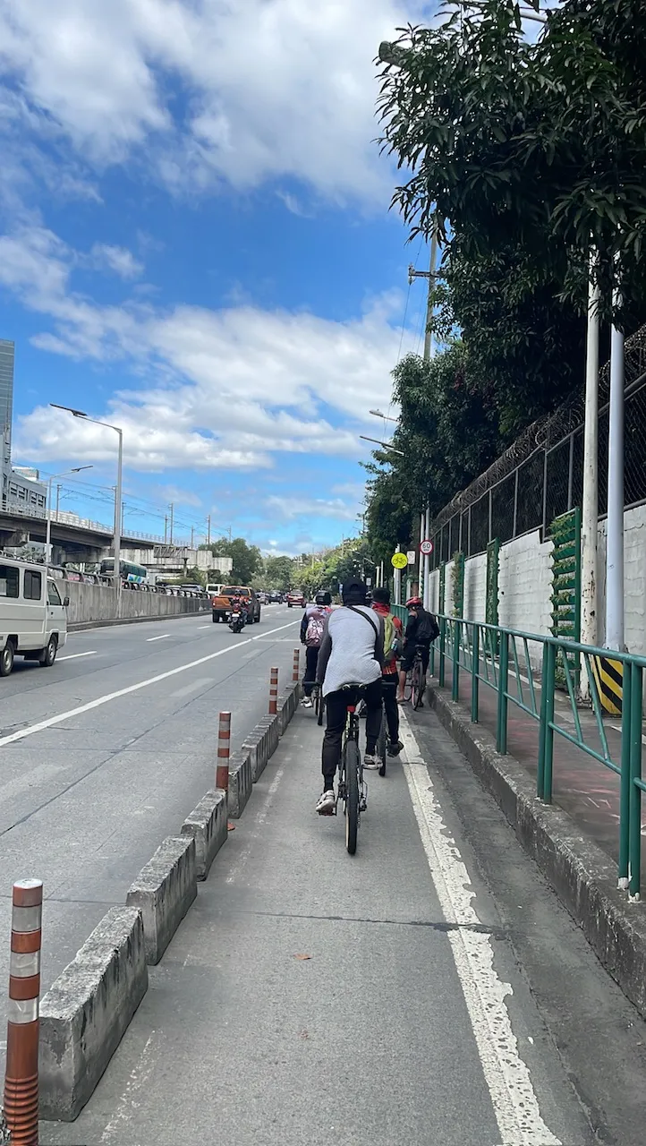
Photo: Chi Señires, CC BY-SA 4.0, via Wikimedia Commons
For much of the past two decades, American cities have pursued two laudable but frequently competing goals simultaneously: expanding protected bicycle infrastructure to encourage low-carbon short-distance commuting, and building dedicated bus corridors capable of moving large numbers of people quickly through dense urban environments. Both ambitions are well-founded. Both have delivered real results. And in city after city, they have also collided—sometimes literally—in the contest for finite street space.
The conflict is not theoretical. When Seattle extended its downtown bus rapid transit network, planners found themselves in protracted negotiations over whether a planned protected bike lane on a parallel corridor would absorb enough general traffic to compromise bus travel times. In Chicago, the expansion of the Divvy bike share network raised persistent questions about whether docking stations placed near bus stops were impeding boarding operations. In San Francisco, the long-running debate over Market Street's redesign became in part a proxy war between cycling advocates and transit operators over which mode deserved priority treatment.
What is changing—slowly, unevenly, but meaningfully—is the design vocabulary available to planners navigating these conflicts. A new generation of street configurations is emerging that treats bikes and buses not as rivals for the same lane but as complementary elements of a coherent mobility system.
Why the Conflict Developed in the First Place
Understanding the tension requires understanding how each mode's infrastructure was historically planned. Bus rapid transit corridors, developed largely in the 1990s and 2000s, were designed around a simple premise: remove buses from mixed traffic, give them dedicated right-of-way, and travel times improve dramatically. The preferred location for that dedicated lane was typically the outermost lane of a wide arterial—exactly the position that cycling advocates, working from their own well-established design principles, identified as optimal for protected bike infrastructure.
Both communities were drawing on sound reasoning. Buses benefit from curbside lane placement because it aligns with stop locations and minimizes weaving conflicts with general traffic. Cyclists benefit from curbside placement because it separates them from higher-speed vehicle lanes while keeping them accessible to destinations. Neither set of planners was wrong, precisely—they were simply operating from frameworks that had never been required to account for each other.
The result, in many cities, was a series of ad hoc compromises: bike lanes that terminated abruptly at bus corridor boundaries, bus stops positioned in ways that forced cyclists to merge awkwardly into traffic, or protected lanes placed in suboptimal locations that reduced their effectiveness as commuting infrastructure.
The Geometry of Coexistence
Several technical approaches have emerged from cities actively working to resolve these conflicts, and while no single solution fits every street context, a few configurations have demonstrated particular promise.
The floating bus stop—sometimes called a bus boarder island—is perhaps the most widely adopted innovation. Rather than placing the bus stop at the curb and forcing cyclists to navigate around boarding passengers, this design positions a narrow boarding platform between the bike lane and the travel lane, allowing buses to stop adjacent to the island while the protected bike lane continues uninterrupted behind it. Riders board and alight from the island rather than the sidewalk. Cyclists never encounter a stopped bus in their path.
New York City has deployed floating bus stop configurations along portions of its Select Bus Service network, and early observations have been encouraging. Cyclist throughput at stop locations improved, and bus dwell times were largely unaffected by the reconfiguration. The design does require additional street width to accommodate the island—a constraint that limits its applicability on narrower corridors—but on arterials with sufficient cross-section, it has proven highly functional.
A second approach involves vertical separation rather than horizontal reconfiguration. Some cities have experimented with elevating the bike lane slightly above the travel lane grade while maintaining curb-level bus stops, creating a physical distinction between the two surfaces that clarifies right-of-way without requiring additional width. This configuration has seen application in Portland, Oregon, where the combination of relatively wide arterials and an active cycling culture made the investment easier to justify.
Lessons from the Field
Indianapolis offers an instructive case study in the challenges and rewards of integrated planning. When the city developed its Red Line bus rapid transit corridor—one of the first true BRT lines in Indiana—planners made a deliberate decision early in the process to map the proposed route against the city's existing and planned cycling infrastructure. Where conflicts were identified, they were addressed during design development rather than after construction.
The result was a corridor that incorporated protected bike lanes on parallel streets rather than the BRT alignment itself, with improved crossing treatments and wayfinding designed to make the transfer between modes intuitive. Ridership data from the Red Line's first full year of operation suggested that the integrated approach contributed to higher-than-projected multimodal trips—commuters cycling to Red Line stations rather than driving to park-and-ride facilities.
In Washington, D.C., the District Department of Transportation has been developing what it describes as a "mobility lanes" framework—a planning standard that explicitly requires new corridor projects to evaluate bike-transit interaction during the design phase rather than treating the two modes as separate workstreams. The framework is still evolving, but its adoption as an official planning standard represents a meaningful institutional shift.
Technology's Supporting Role
Beyond physical design, technology is beginning to play a supporting role in managing the interaction between bikes and buses in real time. Several cities are testing signal priority systems that can respond to both approaching buses and high-density cycling volumes simultaneously, adjusting cycle timing to reduce conflicts at intersections where the two modes converge.
Mobile applications that provide real-time information about both bus arrivals and bike share availability are also becoming more sophisticated, allowing commuters to plan multimodal trips with greater confidence. When a rider knows that a bike share dock at their destination station has available bikes, the calculus of combining cycling and transit becomes more reliable—and more attractive.
The Broader Principle
What the most successful projects share is a planning philosophy that refuses to treat street space as a zero-sum competition. Dense American cities are not going to acquire new right-of-way. The lanes that exist today are, in most cases, the lanes that will need to serve every mode tomorrow. The question is not whether bikes and buses can share the street—the evidence increasingly suggests they can—but whether cities are willing to invest in the design sophistication and cross-departmental coordination required to make that sharing work.
For commuters, the stakes are practical. A city that successfully integrates its cycling and transit infrastructure creates a network where more trips become feasible without a car. A city that allows the two modes to undermine each other produces a system where neither performs as well as it should. Getting the geometry right is not an aesthetic exercise. It is a prerequisite for the kind of multimodal mobility network that American cities have been promising for years.